

Responsible tourism & Movement data
The potential of movement data
Movement data, also known as visitor flow data, refers to the information collected from various sources that track the movements of tourists. It includes data obtained from GPS devices, mobile applications, social media check-ins, transportation systems, and other location-based technologies. This data provides valuable insights into the spatial and temporal patterns of tourist movements, including their origin, destination, routes taken, duration of stay, and activities engaged in.
This information can be invaluable to travelers, locals, and various tourism stakeholders. By consulting live graphs, travelers and locals can plan their visits without worrying about excessive waiting times and crowds. By analyzing real-time data with the help of Artificial Intelligence, tourism officials and businesses can make more informed decisions about how to market their destination, which attractions to promote, and how to allocate resources to improve the overall visitor experience. Problems with exceeding tolerable capacities can be avoided before they even arise. Through visitor guidance measures, travelers can be redirected to less congested areas during peak tourism periods.
Movement data provides many opportunities to make tourism more sustainable:
– Improved destination management: Movement data enables better planning and management of tourist flows, leading to reduced congestion, improved resource allocation and enhanced visitor experiences.
– Sustainable infrastructure planning: By analyzing movement data, destinations can strategically develop or upgrade infrastructure to support sustainable tourism, such as transportation systems and waste management facilities.
– Personalized Sustainable Experiences: Movement data helps deliver personalized recommendations to tourists, promoting eco-friendly attractions, sustainable transportation options, and responsible consumption.
– Environmental Protection: Movement data helps identify sensitive ecological areas, monitor the impact of tourism on biodiversity, and implement measures to protect natural resources.
– Stakeholder collaboration: Sharing travel data fosters collaboration among stakeholders, leading to joint initiatives, informed decision-making, and collective efforts to promote sustainable tourism.
This challenge seeks to harness the power of movement data to unlock new opportunities and pave the way for a more sustainable future in the tourism industry. You are invited to choose a specific challenge from one of our destination partners, Ausserland, Werfenweng or Upper Austria.
Harnessing Movement Data for Nature Conservation in Ausseerland
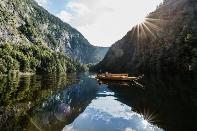

Ausseerland, a picturesque region in Austria, is renowned for its diverse flora and fauna. However, increasing human activities, such as tourism and development, pose significant threats to the delicate ecological balance. To ensure the preservation of this pristine natural environment, there is a need to develop innovative solutions that leverage movement data to enhance nature conservation efforts in Ausseerland.
As a region, our goal is to foster resonance and harmony between travelers and our destination, enabling them to develop a deep understanding and appreciation of the local culture, heritage, and natural environment. We are committed to promoting sustainable practices, responsible travel behavior, and minimizing negative environmental and socio-cultural impacts. In this challenge, we invite you to develop innovative, data-driven solutions that use movement data to raise awareness among travelers about conservation in the Ausseerland region.
How might we use movement data to promote nature conservation among travelers in Ausseerland?
Rather than imposing bans, we want to focus on promoting responsible behavior among visitors, especially with regard to staying on designated trails and respecting sensitive areas. Many of our hiking and biking trails pass through land owned by the Austrian Federal Forestry Office and privacy owners as well, which is regulated by user agreements. As we expand our trail network, we recognize the importance of being good stewards of the land. While we have physical trail systems in place, they are not always effective. Therefore, we are seeking technology solutions that use data to increase awareness, facilitate learning, and guide visitors toward responsible behavior. We firmly believe that cultivating respect for nature is fundamental to its preservation.
While we currently have knowledgeable rangers who provide valuable insights and facilitate exploration, their presence is limited and we seek to augment their expertise through technology. How can data-driven approaches enabled by Artificial Intelligence encourage responsible visitor behavior? For example, there may be instances where travelers unknowingly encroach on the habitat of the capercaillie, a vulnerable bird species. We want to use data to address such challenges and increase visitors’ awareness of their impact on the environment.
In this challenge, we encourage you to propose innovative solutions that utilize movement data to promote responsible behavior, enhance visitors’ understanding of the natural environment, and support nature conservation in Ausseerland. By harnessing the power of data, we seek to create transformative experiences that inspire travelers to become active stewards of our precious ecosystems.
Leveraging movement data for seamless and sustainable travel experiences in Werfenweng
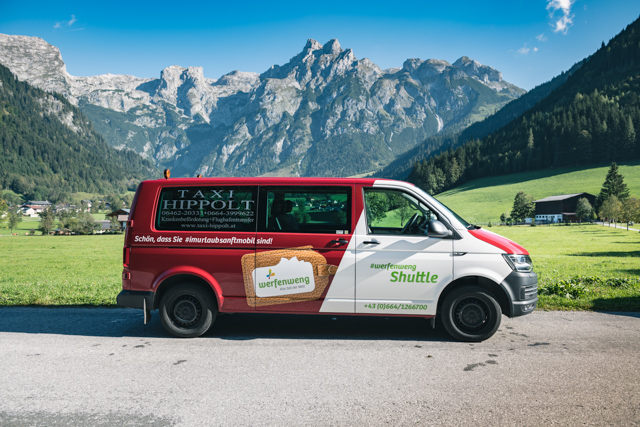

Werfenweng, located in the Austrian Alps, is known for its scenic landscapes, outdoor activities, and eco-friendly initiatives. The destination attracts a significant number of tourists, presenting both opportunities and challenges. To preserve the natural environment and ensure a positive visitor experience, it is crucial to develop solutions that optimize transportation, reduce congestion, and enhance sustainable travel practices.
A significant issue in Werfenweng is the long wait times for shuttles during peaks. There are currently two types of available shuttle services for tourists:
– The W3 Shuttle picks up tourists at the train station and takes them to their accommodations and hotels. The fixed times for the shuttle are coordinated with the train schedules so that tourists can be mobile even without their own car. It also takes tourists to all excursions and hiking destinations in the neighboring communities of Werfen, Pfarrwerfen and Bischofshofen. For tourists with the regional digital tourist card, the Werfenweng Card, the use is unlimited and free of charge.
– The E-LOIS shuttle transports people from the village to their desired destinations and from point A to point B between the hours of 9:00 and 23:00. With the Werfenweng Card, tourists can use this mobility service unlimited and free of charge. This shuttle service is based on the mobility needs of tourists.
Due to limited resources, such as shuttle bus capacity, there are longer wait times of up to 30 minutes for pick-up at certain locations. This is due to the high demand at certain unpredictable peak times. Tourists will then have to wait longer for the shuttle service during peak times and seasons, often due to weather conditions. The weather conditions and rainy days led to strong mobility flows of tourists to the nearest city of Salzburg and a huge increase in demand for individual shuttle and mobility services.
Another problem with local shuttle buses is ineffective fleet management and planning. Often, empty trips are provided, which results in high costs during periods when tourists do not use shuttle services as often and therefore mobility flows are lower. As a result, local shuttle fleet management is currently difficult to plan and tourist demand is difficult to predict. In addition, delays in train connections have a negative impact on local shuttle services, as some shuttle services are adapted to the train schedules of the local train station.
Collecting and analyzing visitor data through Artificial Intelligence enabled solutions can help predict shuttle use, inform sustainable tourism strategies, and balance visitor needs with protecting the local environment and community. Insights gained from visitor data can help to identify high-traffic areas and implement measures to alleviate congestion, reducing wait times and improving the visitor experience.
How might we leverage movement data to effectively manage peak traffic periods in Werfenweng during the summer season?
You are invited to come up with sustainable tourism strategies that we can implement to reduce the pressure of short-term traffic peaks. How could we spread the visitor flows more evenly throughout the day? Can we use technology and Artificial Intelligence to incentivize visitors to travel during off-peak hours and avoid waiting for the shuttle? How can we work with local stakeholders, such as transportation providers and tourism businesses, to develop and implement effective solutions to reduce the impact of overtourism on the local community and environment?
To tackle the Werfenweng challenge, you can work with the following data sources:
– Historical Data from Summer 2022 because there is a higher frequency of used public transport:
– Event Logs from oHA Platform containing Performed Activity (e.g., Booking a Werfenweng Card experiences), Timestamp (when the Event happened), Case (e.g., anonymized Session-ID)
– Historic movement data from mobile phones – Invenium
– Statistics from W3 Shuttle and Elois – Local Shuttle Providers oder Tourism Agency Werfenweng
– Historic Weather data – from MetGIS
In the regional guest portal oHA, tourists can find information and contact to local shuttle services. The most important hotspots for the summer, local POIs, as well as all tourist information, bookable offers, and services, are listed and available for tourists in the guest portal oHA. Also, the Werfenweng Card can be purchased through the guest portal oHA.
Enabling partners with movement data to tackle overtourism in Upper Austria


Upper Austria is a picturesque region located in northern Austria, known for its stunning lakes, forests, and mountains. The region has become an increasingly popular tourist destination in recent years, with visitors enjoying the natural beauty, cultural heritage, and wide range of outdoor activities. However, the influx of tourists has also brought about the challenge of over-tourism, leading to issues such as overcrowding, traffic congestion, and strain on local resources and infrastructure. This not only impacts the quality of life of local residents but also threatens the sustainability of the tourism industry in the region.
Overtourism is a growing problem in many popular destinations worldwide. In tourism hotspots, an excessive number of tourists visit a particular destination beyond its carrying capacity, causing damage to the environment, disrupting local communities, and degrading the tourist experience. Overtourism can result in economic, social, and environmental issues, and it is a significant challenge for the travel industry and local governments.
We learned valuable lessons in a pilot project last summer that showed the occupancy rate of known hotspots in Salzkammergut:
– Auslastungsmonitor OÖ: Shows data from various integrated systems with geolocation on a map and in traffic light colors.
– Bäderampel Attersee: Uses the same data sources and shows the live data of the Salzkammergut bathing areas in traffic light colors and as a percentage of the total capacity.
From these tests, we know that local people, long-term guests, and frequent visitors used this information for their short-term planning. Now, we want to take the movement data to the next level. We aim to bring this information to visitors across various touch points by enabling our partners to use the data.
Our challenge is to develop, enhance and improve the means of visitor guidance and local services based on near-real-time mobile data. One option is to continue building upon our “Bäderampel Attersee” pilot. Another path is to focus on the BergeSeen Trail. For this popular activity, visitor guidance could help partners forecast the expected bikers to arrive at the end of the day plan their capacity accordingly. Bikers logged in (with acceptance for push notifications) could be informed of daily specials or events in the evening at their target destination via Applications like outdooractive.com, myOberösterreich or Upperguide OÖ:
How might we enable tourism actors to contribute to more sustainable tourism with movement data in Upper Austria?
To develop ideas, consider the following dimensions:
Tourism stakeholders: Which tourism actors might benefit from real-time visitor data? How can, for instance, accommodation providers leverage data to guide their guests? How can restaurants or mobility providers such as shuttle services benefit? How could destination managers leverage movement data? How might the different stakeholders contribute to better visitor management? What data is relevant for this purpose? How can the individual stakeholders benefit from visitor management?
Data combinations: Think about data combinations that a data ecosystem would allow: What if you combine movement data with weather data? How can sustainable offers be identified and described transparently? Which data granularity is required?
Information dissemination: How and where should the information be shared with travelers?
Business case: How can data partners be integrated to cover running costs?
Let’s make travel experiences more enjoyable while improving the impact on the environment and local communities.
Your ideas
These three challenges aim to encourage the development of innovative solutions that utilize movement data to enhance sustainable travel experiences. Let’s use data to reduce the negative impacts of tourism and enhance the positive outcomes.
Collaboration incentive
The best team from each movement data challenge will be invited to a travel experience combined with developing your ideas.
Ausseerland: We invite the winners to a 3-day stay in the Ausseerland Salzkammergut, including: meetings with stakeholders (Austrian Federal Forestry Office, Nature Mentor and more), time to explore the region and its beautiful nature, discussion of ideas with the Ausseerland Salzkammergut Tourism Board.
Werfenweng: The team with the best idea will be invited for two nights in one of the largest chalets of Woodridge Luxury Chalets. Each participant in the team will receive a Werfenweng Card for the stay. They can use this to explore the Werfenweng region and its beautiful and attractive offers. Furthermore, during their stay, the winners will have the opportunity to present their ideas directly in the Werfenweng region and discuss them with the Werfenweng tourism board.
Data partners
Our data partners Invenium, Hutchinson 3 , Outdooractive, and LuxActive provide data for the destinations that you can use for your idea.
About Invenium
Founded in 2016 Invenium is part of the A1 Austrian Telekom Group and has its business in five market countries in Europe. With the platform “Mobility Insights”, Invenium creates a new view of human movement flows and patterns using state-of-the-art algorithmic models, powerful Big Data based on anonymized mobile signaling data. The generated insights support companies from different industries, for example “Retail”, “Transportation”, “Public Institutions” as well as Tourism in gathering insights about mobility flows. Invenium’s mission is to make human mobility visible and understandable.
Weather data by MetGIS
To include weather data in your solution, you can build on the data by MetGIS.